

Application received
- May 2008
Registration date
- 23 May 2008
Registered Aboriginal Party boundaries
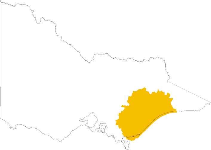
Download a map showing the boundaries for the Gunaikurnai Land and Waters Aboriginal Corporation:
Gunaikurnai Land and Waters Aboriginal Corporation - map of Registered Aboriginal Party boundaries
(opens in a new window)
You can also view an online map(opens in a new window) showing all Registered Aboriginal Party boundaries in Victoria. The map works best in Chrome.
Once the online map is displayed:
- Click the Layers icon on the toolbar above the map
- Select the Appointed RAPs checkbox
Contact
Nick Ashburner - CEO
Email: nick.ashburner@glawac.com.au(opens in a new window)
Phone: 03 5152 5100
Website: www.gunaikurnai.org(opens in a new window)
Council decisions about Gunaikurnai Land and Waters Aboriginal Corporation
GLaWAC RAP appointment May 2008
(opens in a new window)
DEC 2008 Further decision for GLaWAC RAP application
(opens in a new window)
DEC 2010 RAP area extension
(opens in a new window)
MAR 2011 Further decision GLaWAC RAP application
(opens in a new window)
MAY 2012 Further decision GLaWAC RAP application
(opens in a new window)
MAY 2017 Further Decision GLaWAC RAP Application
(opens in a new window)
Updated